We use cookies to make your experience better. To comply with the new e-Privacy directive, we need to ask for your consent to set the cookies. Learn more.
Archaeology
-
The Archaeology of Life and Death in the Boyne Floodplain (NRA Scheme Monographs)Special Price €17.99 Regular Price €29.99
The Linear Landscape of the M4, Kinnegad-Enfield-Kilcock Motorway. BOOK AND CD.
-
Roads, Rediscovery and Research (NRA Scheme Monographs)Special Price €17.99 Regular Price €29.99
Archaeology and the National Roads Authority Monograph Series No.5
-
New Routes to the Past (NRA Scheme Monographs)Special Price €17.99 Regular Price €29.99
Archaeology and the National Roads Authority Monograph Series No.4
-
Excavations Bulletin: Excavations 2004 (Hardback)Special Price €23.99 Regular Price €39.99
The Excavations Bulletin is a compilation of summary accounts of archaeological excavations in Ireland. This edition edited by Isabel Bennett covers the year 2004.
-
Monumental Beginnings: The Archaeology of the N4 Sligo Inner Relief Road (NRA Scheme Monographs)Special Price €17.99 Regular Price €29.99
Who were Ireland's earliest farmers? Where did they come from? How did they live? BOOK AND CD
-
Archaeology and the National Roads Authority (NRA Scheme Monographs)Special Price €17.99 Regular Price €29.99
Proceedings of Two Seminars in 2002 on the Provisions for Archaeological Work within the National Roads Programme, Dublin, 27 February 2002 and Tullamore, 29 May 2002 no.1
-
 New Survey Of Clare Island: v.5: Archaeology€20.00
In 1909-11 Robert Lloyd Praeger brought a team of 100 European multidisciplinary specialists to map the flora, fauna, geology and archaeology of Clare Island, a small, exposed Atlantic island off the west coast.
-
The North Munster Project : Volume 1 and 2 (Set of Two Hardbacks)Special Price €49.99 Regular Price €59.99
The North Munster Project was the first research undertaking of the Discovery Programme when it began in 1992. The Project was designed to provide an integrated regional landscape assessment of the lower catchment of the River Shannon in later prehistoric (middle Bronze Age to Iron Age).
-
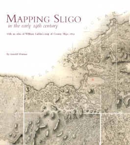 Mapping Sligo in the Early 19th Century - with an atlas of William Larkin's map of County Sligo 1819 (Hardback)€39.99
96 pages with 50 colour and mono plates hardback, very large format