We use cookies to make your experience better. To comply with the new e-Privacy directive, we need to ask for your consent to set the cookies. Learn more.
This new edition shows the new motorway network in Clare and Limerick. A handy map of Ennis Town centre has been added as well as many new walking and cycle trails. This popular map has a comprehensive set of tourist destinations including the Burren, the Aran Islands and the Cliffs of Moher. This detailed touring map provides a unique representation of County Clare - "The Banner County".
There is information on antiquities, leisure spots, touring routes for motorists, cycling routes and walking trails. It covers famous destinations such as the Burren and the Cliffs of Moher but also includes many lesser known spots that are equally interesting and enjoyable. A comprehensive selection of golf courses, angling spots, beaches, historic sites, tourist centres and many other points of interest are clearly shown.
The scale of the Clare map is 1:80,000. This title is waterproof and Rip-Proof. It includes a detailed Index. Tourist Attractions highlighted, as well as walks, cycle routes and scenic drives. This title includes Ennis Town Centre map showing pedestrian areas and park. It covers local mountains, rivers and lakes.
| ISBN/EAN | 9780955265549 |
|---|---|
| Author | Harry Styles |
| Publisher | Xploreit Maps |
| Publication date | 1 Feb 2012 |
| Format | Fold-out Map |
Write Your Own Review
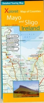
Xploreit Map of County Clare, Ireland
This new edition shows the new motorway network in Clare and Limerick. A handy map of Ennis Town centre has been added as well as many new walking and cycle trails.
Estimated delivery in 1-5 working days
Read more about our shipping and delivery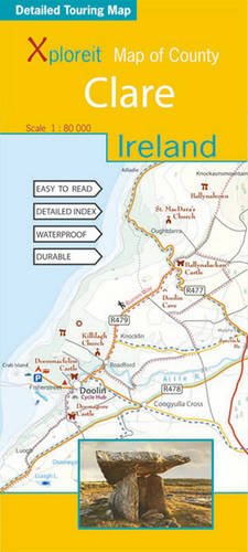
OTHER PRODUCTS YOU MIGHT LIKE!